


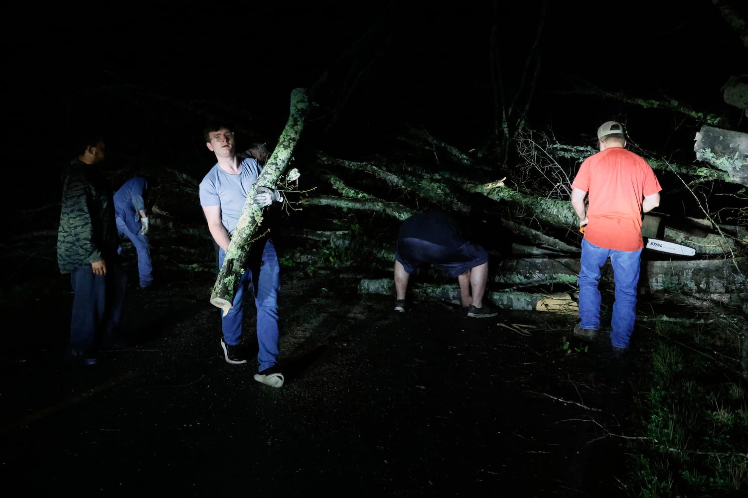


The expected severe weather arrived on Saturday night in Georgia, with storms hitting metro Atlanta by midnight.
Georgia’s western border and parts of the metro’s west side were under a Level 4 of 5 risk for severe weather Saturday and Sunday, the National Weather Service warned. A large portion of the rest of the state was under a Level 3 risk. The locations under a Level 4 threat carried a 15% chance of tornado formation within 25 miles of any given point. Areas under a Level 3 threat had a 10% chance.
Here’s the latest on the aftermath of the severe weather.
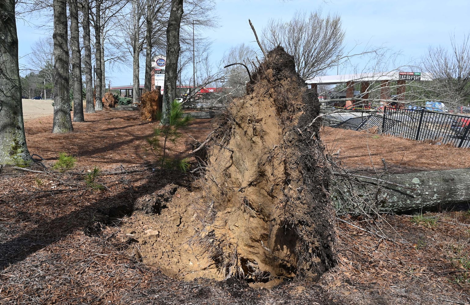
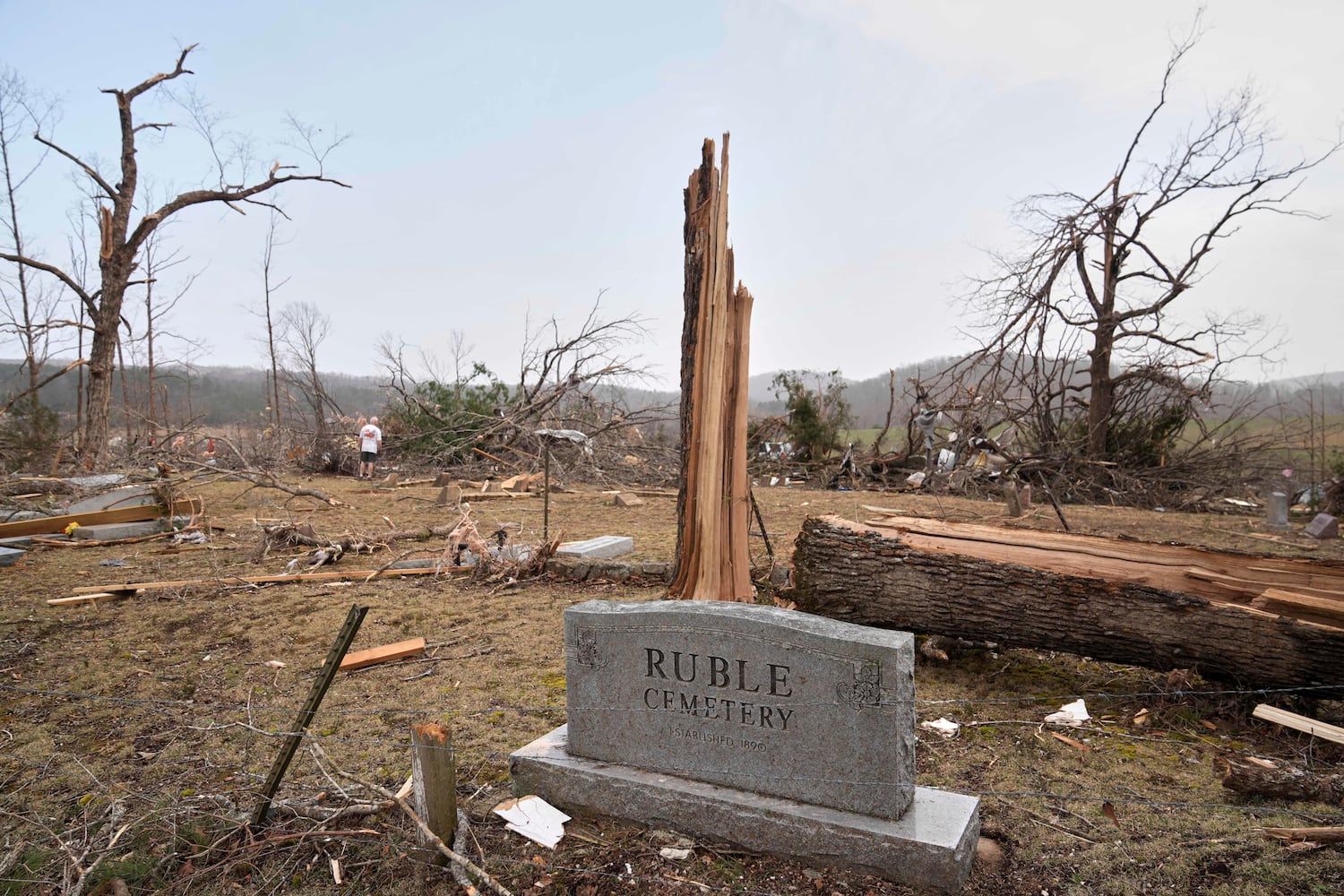
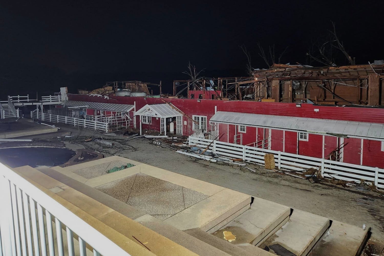
An EF-1 tornado touched down in Paulding County during the severe storms over the weekend, a National Weather Service meteorologist confirmed to the Atlanta Journal-Constitution on Sunday evening.
The tornado reached the ground at about 11:45 p.m. Saturday with maximum sustained winds of 110 mph, the meteorologist said.
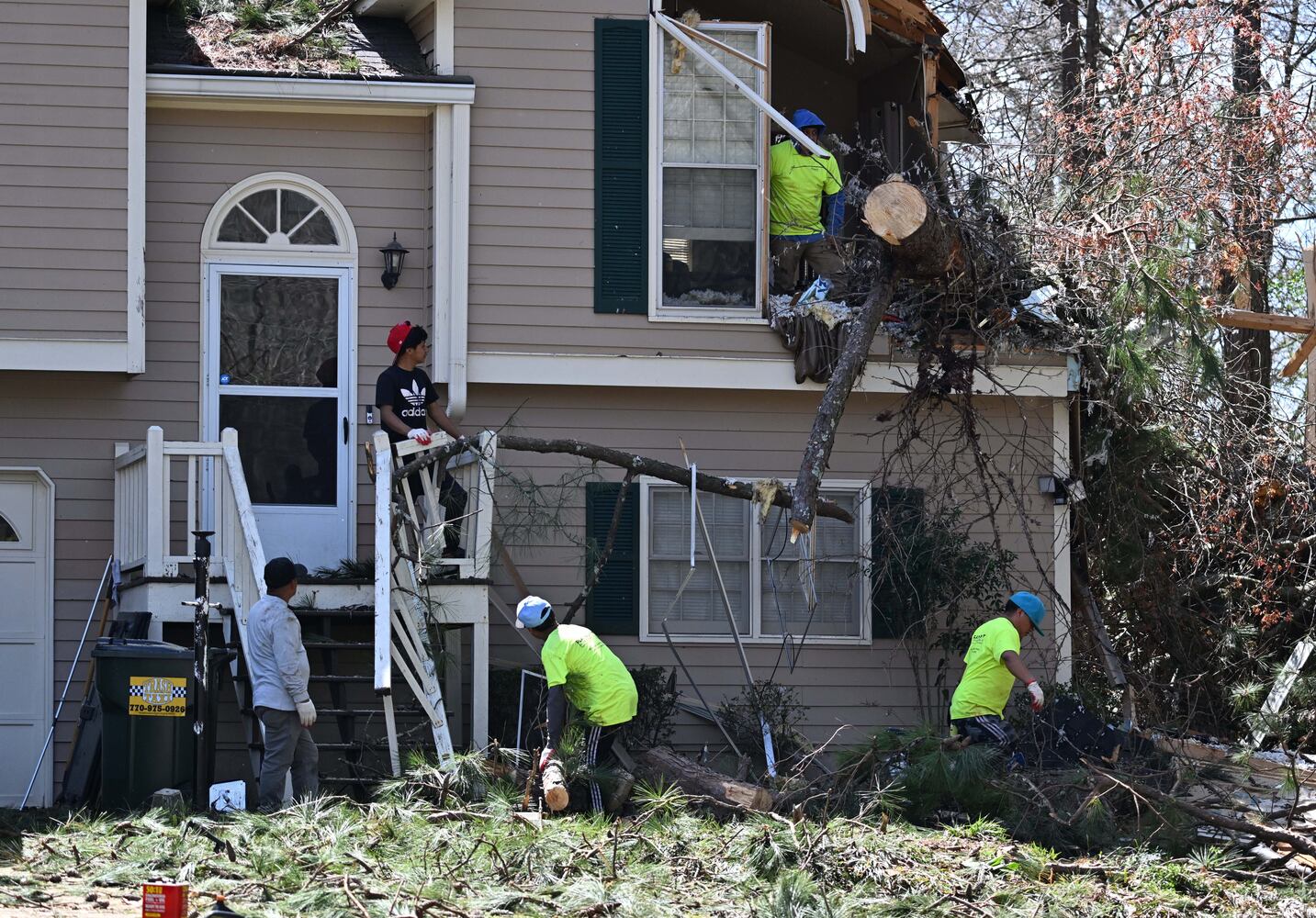
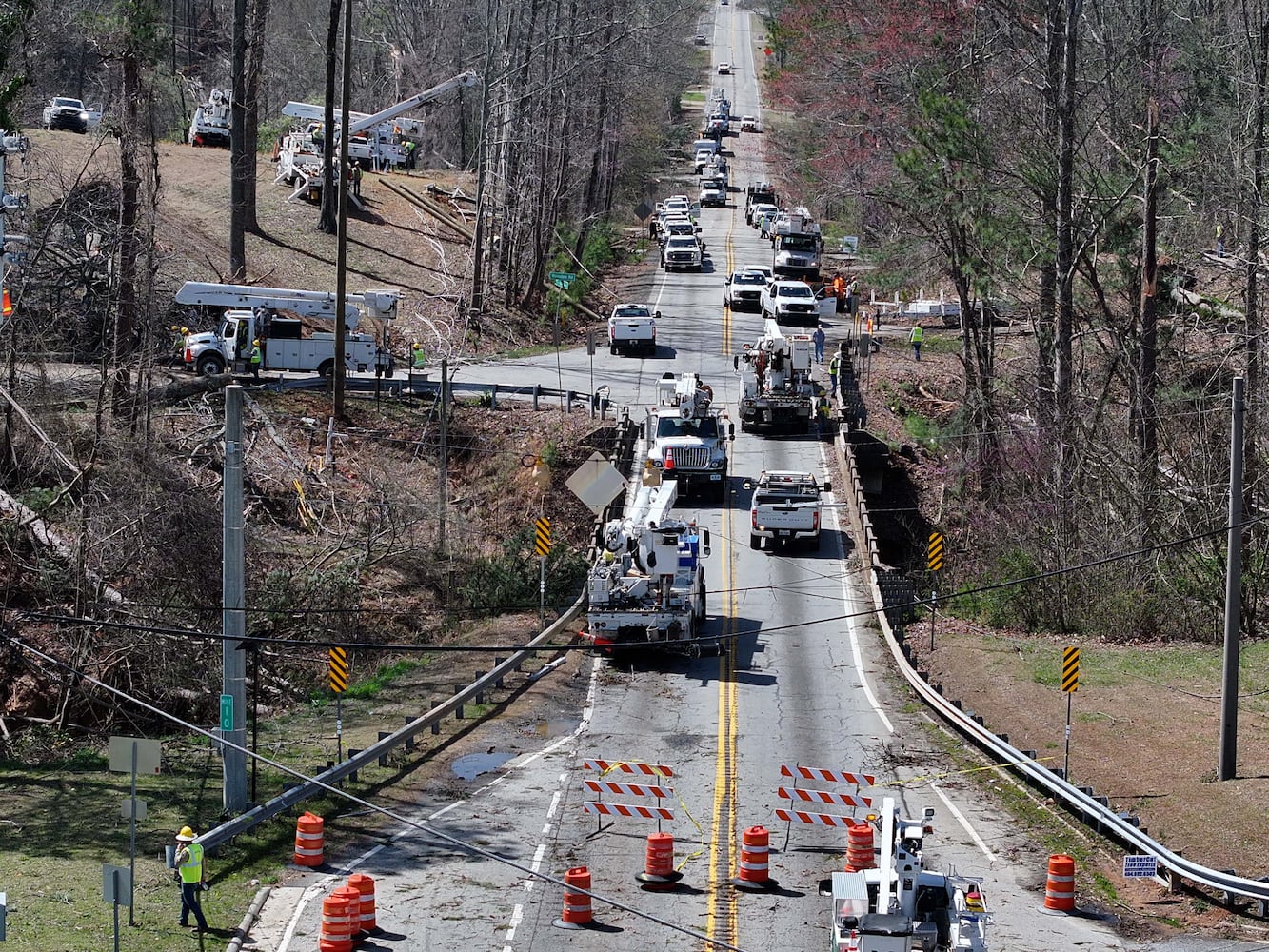
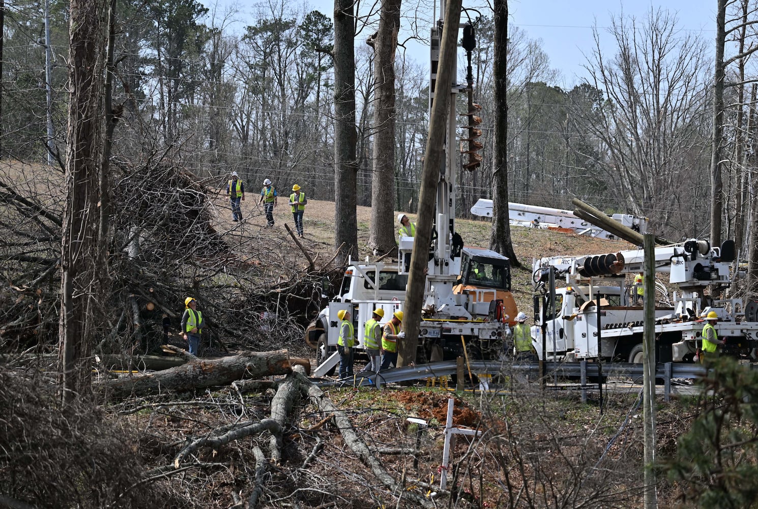
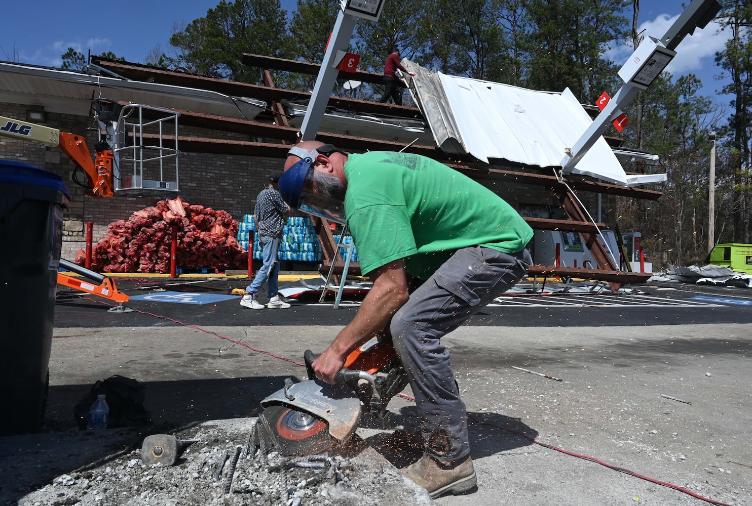
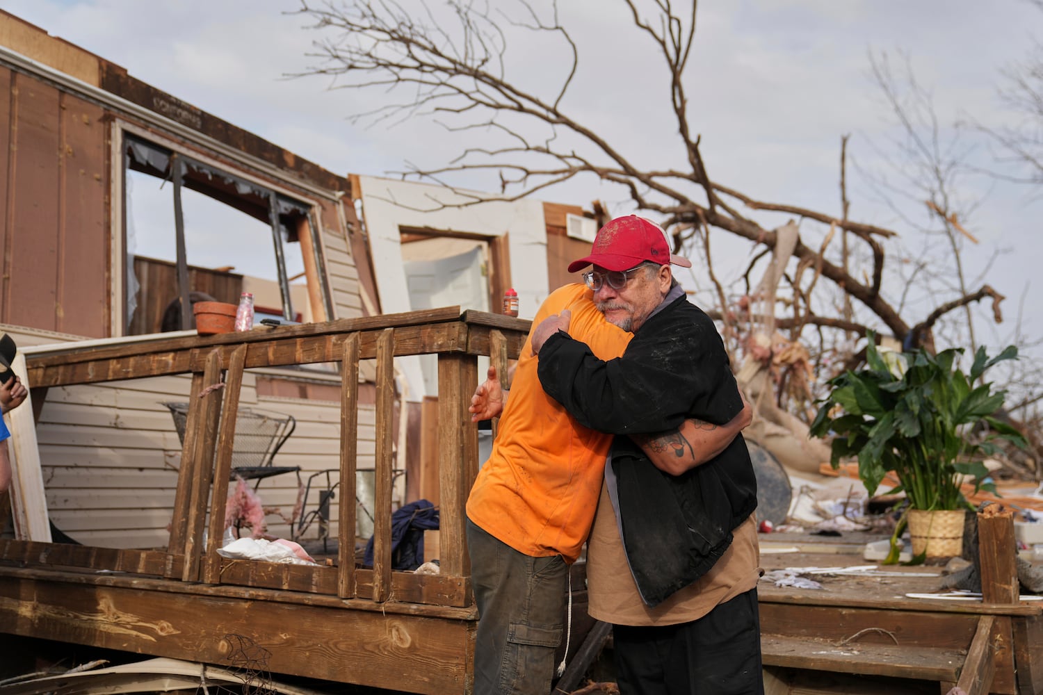
The county was one of the worst areas hit, with at least 14 homes impacted by trees and 12,000 residents without power as of Sunday afternoon, according to Paulding Sheriff Ashley Henson.
Like much of metro Atlanta, Savannah was also mostly unscathed from the severe weather that damaged homes and power outages throughout the state.
A meteorologist from the National Weather Service in Charleston, S.C., which covers Savannah, said it was fairly quiet outside of some thunderstorms and heavy wind gusts that reached up to 47 mph at the airport just before 8:30 a.m. Sunday.
The main line of storms that had concerned the NWS eventually moved off the coast of Savannah by the early afternoon. By 5 p.m., a few additional storms had yet to move through.
There were a few reports of small dime-sized hail that fell in the city during the storms, but no reports of flooding or injuries, the meteorologist said. He added that there were no reports of fallen trees or major damage.
"In these powerful storm systems, the damage and severity is generally a lot worse farther inland, and then by the time it gets to the coast, it kind of runs out of steam," the meteorologist said.
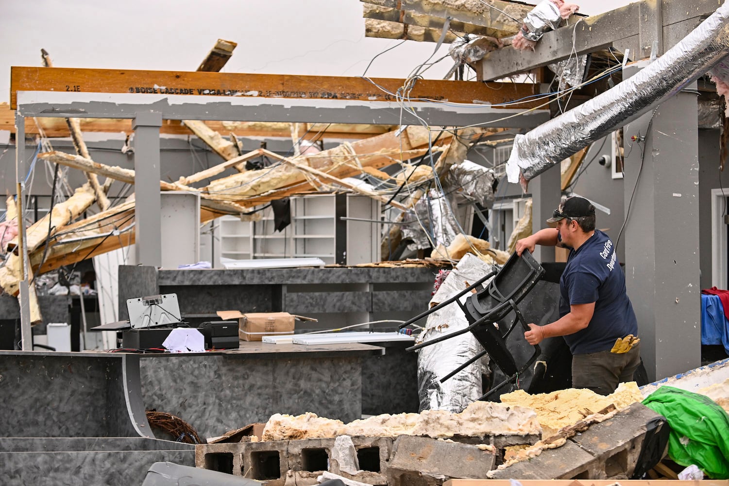
DALLAS — Dozens of roofing and restoration contractors descended on the Dallas area Sunday, looking for business with homeowners in need of repairs.
“I’m sure you got a hundred people giving you cards,” Aaron Moon, a storm damage restoration contractor, said to resident Clifford White as he handed over his business card.
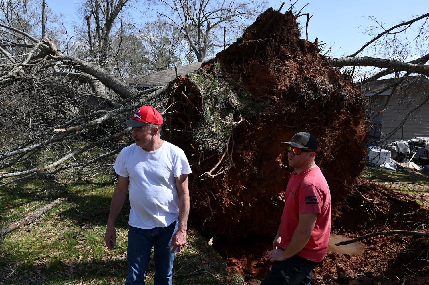
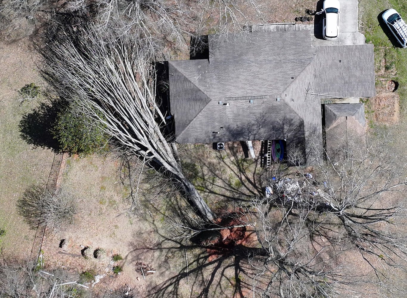
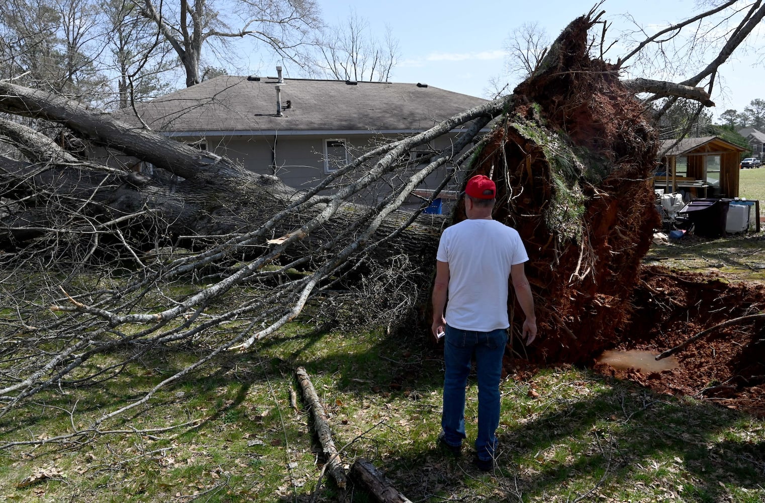
Part of White’s roof had been damaged after a 50-foot oak tree uprooted and collapsed next to his house, nearly missing his roommate’s bedroom.
Moon, 38, estimated that replacing White’s roof would cost about $15,000. Half an hour later, two more contractors from Humbled Roofing & Restoration added to the pile of business cards in White’s hand.
Paulding County Sheriff Ashley Henson urged residents in a Facebook live Sunday afternoon to be wary of scammers as contractors swarm Dallas.
“Don’t get scammed. Do not give anyone any money before they do any work,” Henson said. “We’ve got a mess and we don’t have time to deal with folks getting scammed.”
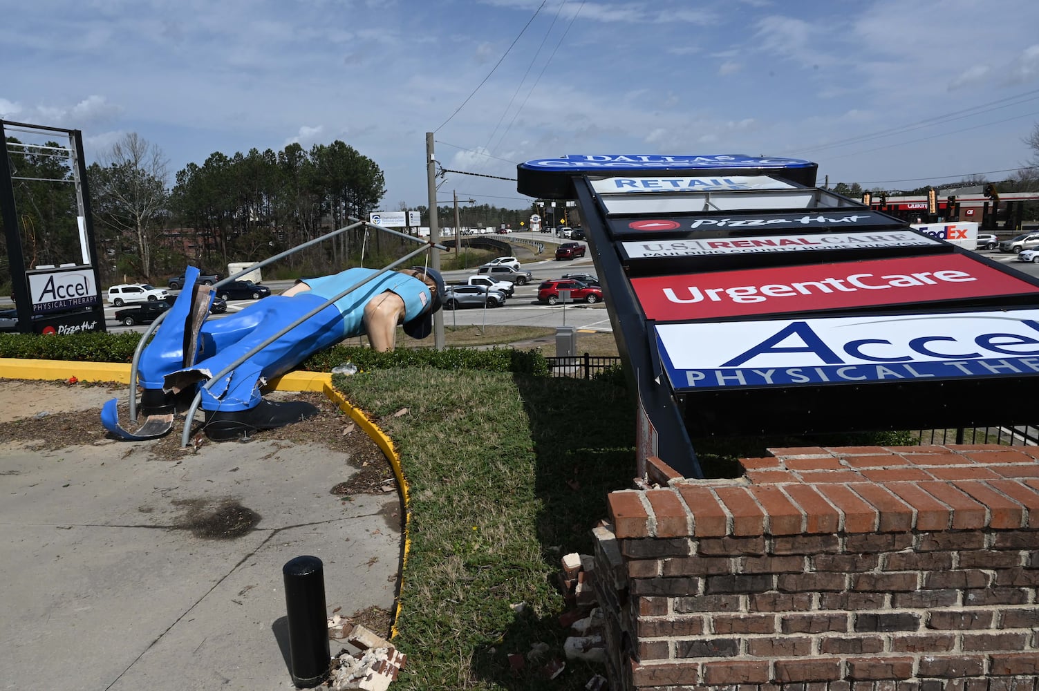
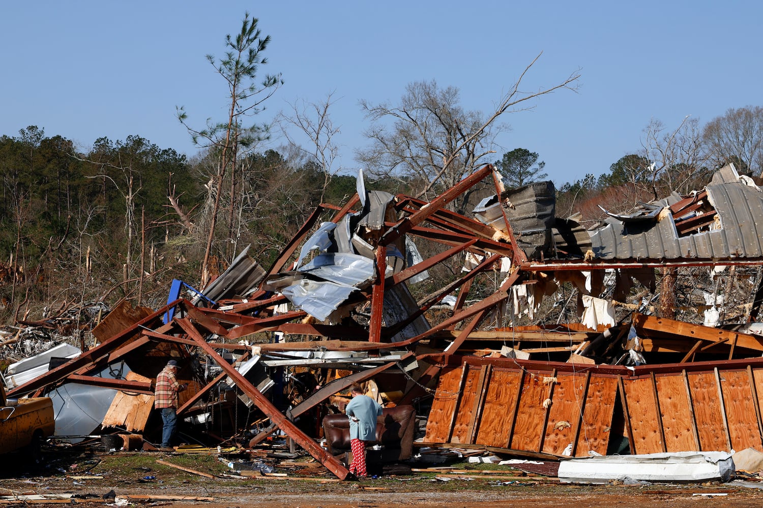
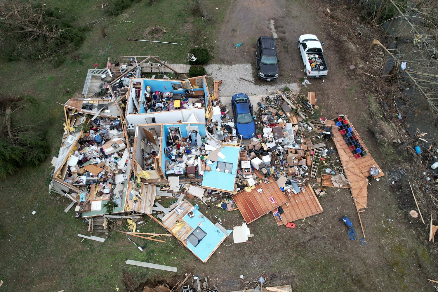
DALLAS — Motorists in Dallas sat in traffic Sunday morning on US-61, looking around at the devastation in the wake of the storm — ripped off billboard signs, homes cut in half by fallen trees and scattered power lines.
Paulding County Sheriff Ashley Henson said in a Facebook live that 14 homes were impacted by trees and 12,000 were out of power as of Sunday afternoon.
“By the grace of God, nobody was hurt,” he said. “We’re so thankful for that.”
Lucky Singh, owner of a Texaco gas station, was not so lucky, incurring $150,000 in damages after the storm wrenched the gas station’s canopy off its bolts and flung it onto the convenience store’s roof. He said the insurance company will only cover $40,000 and will most likely have to pay the remaining balance out of pocket.
“It’s really bad,” he said. “Branding, imaging is expensive.”
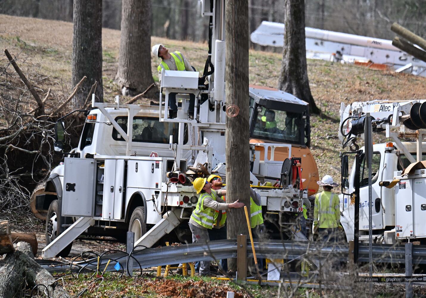
The National Weather Service issued a tornado watch for north and west Georgia until 4 a.m. Sunday. Thousands in the metro Atlanta area remained without power Sunday morning, including about 3,000 customers in Fulton County, according to Georgia Power.
DALLAS — Clifford White said he knew he was in trouble late Saturday after witnessing power lines spark together to create what he described as a "light storm" in Paulding County.
In front of his house, he then saw cars driving into branches that had already fallen into the road.
By midnight, his one-story house started to shake violently. At that point, the storm was in full force as rain pounded down the pavement and powerful wind gusts whipped around his residence.
“It felt like an earthquake,” he said. “All we felt was the house shaking.”
About 15 minutes later, the wind had died down and he walked around the house to survey any damages. An oak tree, at least 50 feet tall, had completely uprooted and clipped the edge of the house, just a couple of feet from his roommate’s bedroom.
“We’re lucky,” he said. “It’s fate.”
As trees battered her house, Shea Zimmerman said she was already hiding behind some cabinets in her kitchen around 11:30 p.m. when she received a shelter-in-place warning on her phone.
“I was shocked I didn’t see trees in my ceiling,” Zimmerman said. “These houses are made of toothpicks.”
Zimmerman eventually rushed to her car in hopes of driving to her friend's basement but noticed the windows were shattered. She then tried to start the car, but something "didn't sound right."
That’s when she noticed the back of her car was no longer there. The storm had ripped her white sedan in half.
Zimmerman said the worst of the storm had passed around 3 a.m., and could not believe her house was left untouched.
“I prayed, prayed and prayed,” she said. “I’m blessed that all the damage went around my whole house.”
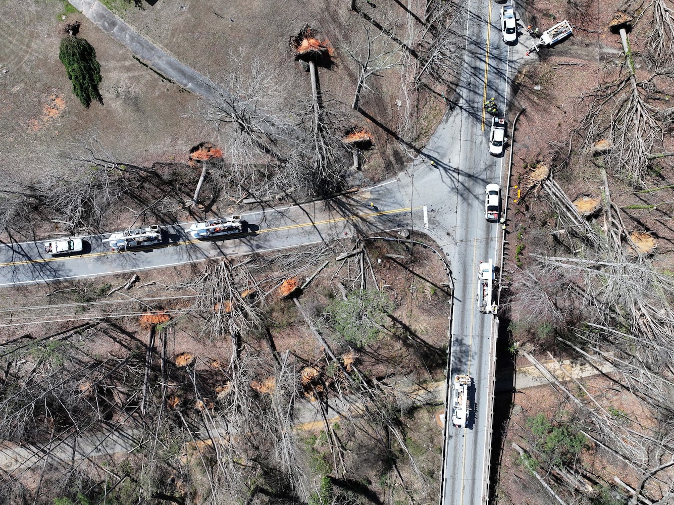
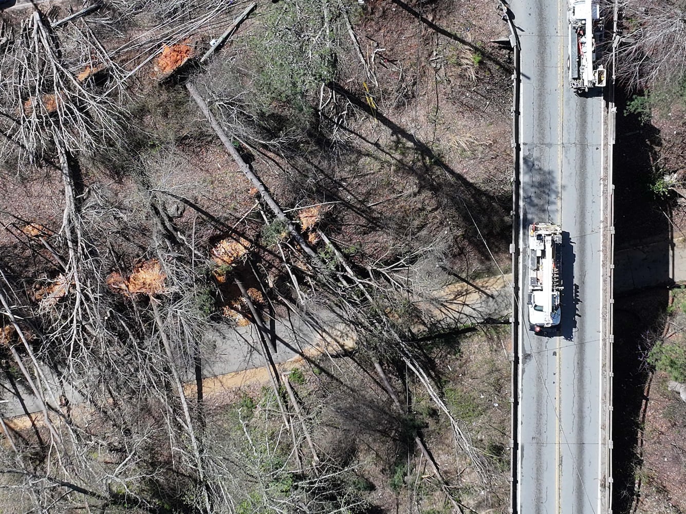
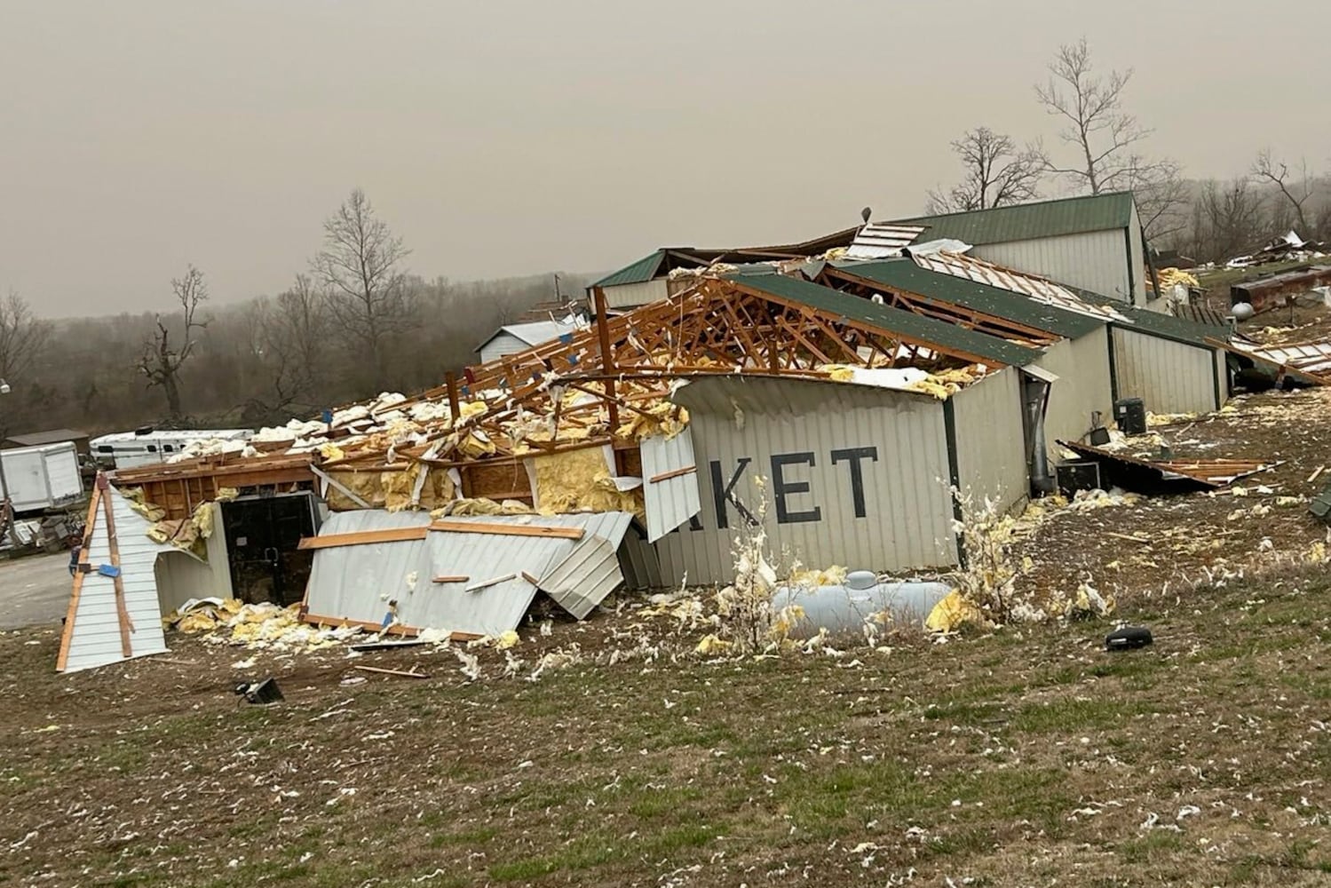
National Weather Service teams will be conducting a damage survey in the Paulding County/Dallas area, which sustained “pretty significant” damage from the storms, NWS Senior Meteorologist Dylan Lusk told The Atlanta Journal-Constitution on Sunday morning.
Lusk said a possible tornado went through the area and that crews were working to confirm if that was the case. A damage survey team will be heading out there around midday Sunday.
“I'll tell you there's a pretty decent chance we'll confirm it based on some of the damage we're seeing out there,” Lusk said.
Outside of Paulding, he said the majority of metro Atlanta escaped major damage from the storms, with the NWS receiving sporadic reports of trees down amid the high winds and thunderstorms.
There were also reports of trees down in Bartow and Cherokee counties. As the storms moved east, Lusk said they “definitely seemed to weaken pretty substantially” before becoming “more of a problem” for Central Georgia.
“We've yet to find any other concentrated damage (aside from Paulding) that might indicate we need to go take a look at it for a potential tornado. But we did have sporadic damage, power outages, things like that, pretty much across a good portion of the state,” Lusk said.
During the severe weather, Paulding, Polk and Bartow counties saw thunderstorms that produced up to four inches of rain over the past 24 hours. The east side of metro Atlanta got about a ½ inch to an inch of rain during that span, while the west side received about an inch to two inches, he added.
Some NWS phone lines were knocked out after strong winds likely caused a power outage in Peachtree City, he said. The strongest winds were seen in Dallas, where a 67-mph gust was recorded. In DeKalb County, a 58-mph gust was recorded at the Emory campus, Lusk added.
In Central Georgia and other parts of the state, wind gusts stayed below 50 mph, according to what was recorded by the NWS.
“That doesn't mean that there weren't stronger winds, it just means it didn't hit one of the sites that could record it,” Lusk said.
The tornado watch for parts of southeast Georgia has expired this morning, concluding hours of watches and warnings for the state.
As the severe weather moved in on Saturday evening, watches and warnings were posted in North Georgia and metro Atlanta for the risk of thunderstorms, tornadoes and flash floods.
This morning, Gov. Brian Kemp posted a note on social media saying his family was “praying for all those impacted by this storm system and those still in its path.”
“We will continue to work closely with state and local officials to respond to damage and assess any needs following this weather event,” Kemp wrote.
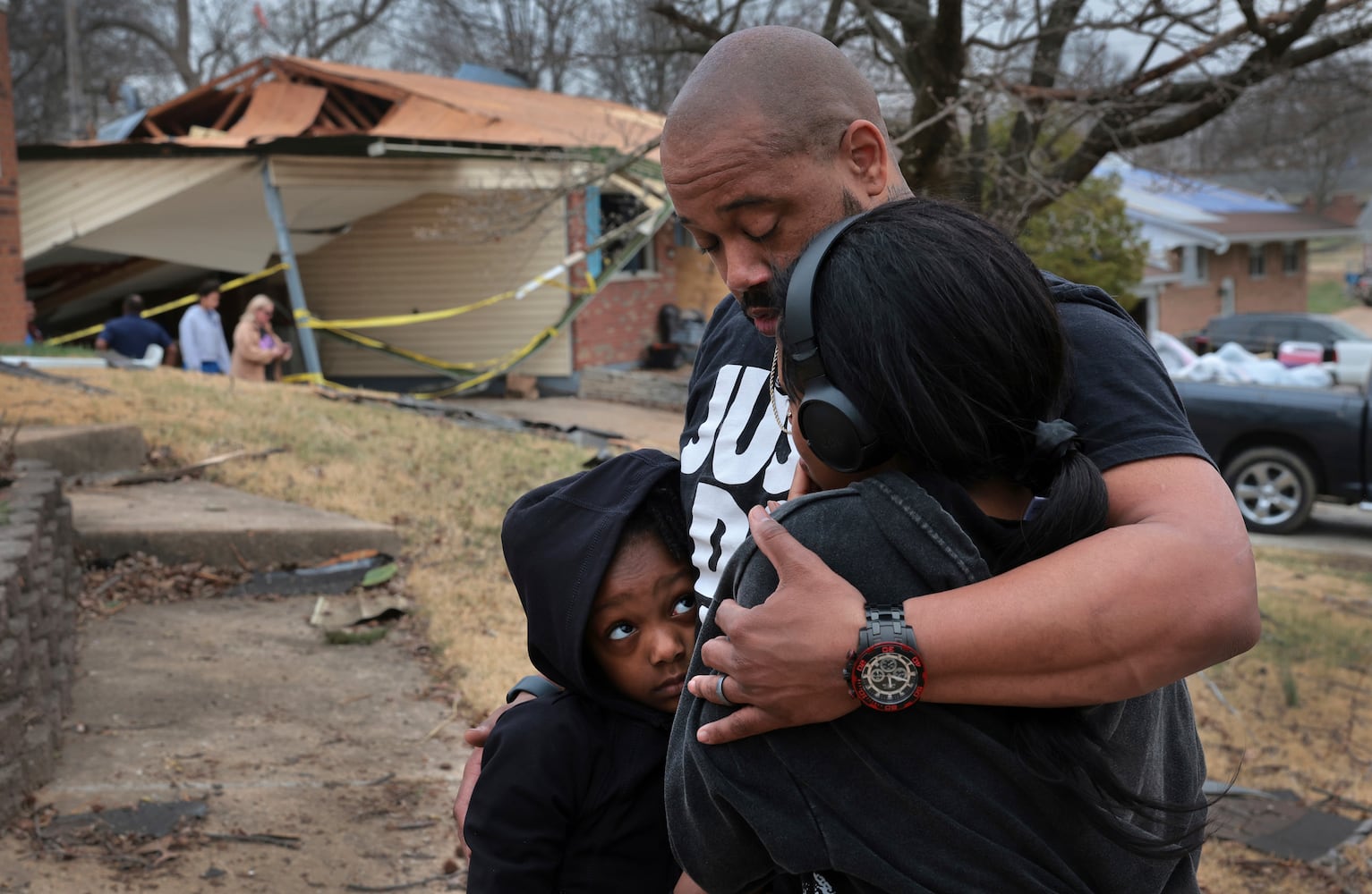
While no Georgia fatalities have been reported this morning, Alabama has at least one death in the wake of the massive system that moved across the U.S.
Dallas County Sheriff Michael L. Granthum said there was one storm-related fatality in that county. No other details were provided.
Alabama was also dealing with tornado damage this morning. At one point on Saturday, Atlanta's National Weather Service office had to take over the duties for Birmingham's NWS office when staffers had to take shelter there because of a tornado in the area.
A tornado watch remains in effect for central and southeastern Georgia until 10 a.m. due to the severe storms, according to the National Weather Service.
The NWS said a severe thunderstorm warning expired for Emanuel and Treutlen counties after the storms moved out of the area. The counties are located about two hours southeast of metro Atlanta.
"It's the final push," the NWS said. "Frequent lightning and gusty winds are the main threats here."
Georgia Power, the state’s largest utility, said more than 20,000 customers were without power as of about 8 a.m. Sunday, down from 60,000 late Saturday.
After restoring power to nearly 10,000 customers, Georgia EMC, which represents the state’s electrical cooperatives, said less than 30,000 were without power.